Category

Rambles

Missives from the trail

Day 13 – Roaring Meg to Tidal River

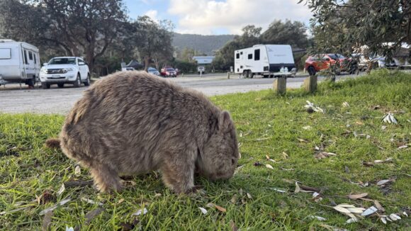
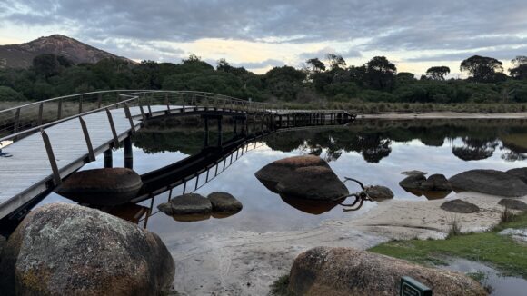
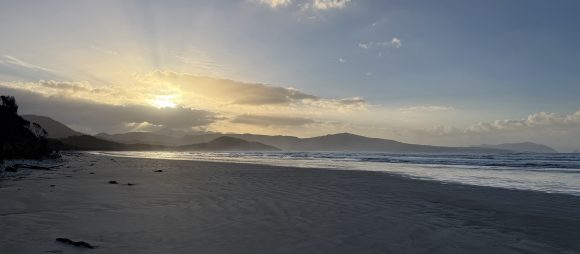
Distance: 25kmElevation: +600m -700mTime: 7hrsTotal Distance: 311km Oh no. What is it? Oh no… What??? I think the line goes to Cape York. We wake in the dark, assemble, and set off southward through the bush by the light of our headlamps. The track is well made, but we still stumble a bunch over shadowy roots and rocks in our haste. The lights of a container ship drift through the shipping lane...
Day 12 – Refuge Cove to Roaring Meg

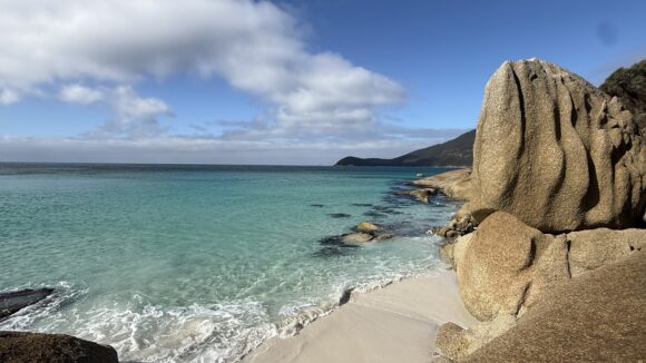
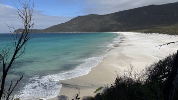
Distance: 24kmElevation: +1200m -1100mTime: 7.5hrsTotal Distance: 286km Well, it doesn’t look like a lot of elevation. –C I wake before dawn with my tarp pitched high and watch the rising glow of daylight spread across the cove from the comfort of my hammock. We eat breakfast on the steps above the beach. I can think of few nicer ways to start the day. We’ve got a 22km, 1200m day ahead of us;...

Day 11 – Tidal River to Refuge Cove

Distance: 23kmElevation: +700m -700mTime: 6.5hrsTotal Distance: 262km Gaiters are like a warm hug for your calves We pack up and hang around until the store opens, then enjoy hat coffee, hash browns and potato scallop-cakes on our way out of the campground. The next few days probably involve more elevation than the rest of the walk combined. In the peak season there’s a shuttle bus that runs to...

Day 10 – Tidal River Zero Day

Distance: 10km We start the day with yet more bad news; Robyn’s friend Ginger has taken ill and won’t be joining us for the next few days as planned. Also the general store is closed for renovations, its delicious gooey centre temporarily out of reach of the trail-famished hiker. Thankfully we weren’t banking on resupply here. We’re gutted. We go for a little walk around the park to collect some...

Day 9 – Yanake to Tidal River

Distance: 37kmElevation: +400m -400mTime: 9.5hrsTotal Distance: 239km Ouch! Why does boiling water have to be so hot? –Robyn Sad sad news from the real world to start the day. As we were setting up camp last night we chatted with a guy who’s just finishing an eleven month lap of Australia with his wife and two young kids. Crazy what some people will do. Took a photo just in case we get lost. We...

Day 8 – Foster to Yanakie

Distance: 30kmElevation: +150m -150mTime: 7hrsTotal Distance: 202km Pffft, René Descartes; what does he know? I brought camp shoes with me to have another try and see if I like them. They’re bulky and weigh 170g, and I’ve used them once. I ditch them with the other orphans by the bins. Every bit helps. We head into town for breakfast at one of the cafés. The day is shaping up to be gorgeous...

Day 7 – Welshpool to Foster

Distance: 22.5kmElevation: +40m -40mTime: 5.5hrsTotal Distance: 172km What’s the most important thing about telling a joke timing I cut my snake bandage in half and use it for a makeshift compression brace. Let’s see how that goes. We walk over to the café and “supermarket” for breakfast. 9/10. With bellies full and rain gear donned, we stride out into the morning drizzle like a couple of hard...

Day 6 – Yarram to Welshpool

Distance: 27.5kmElevation: +40m -40mTime: 7hrsTotal Distance: 150km The improbable adventures of Christopher Robyn. One last look around reveals my missing sock hiding in a garden bed by the laundry. I return it lovingly to the fold. We head to Yarram bakery cafe too early for breakfast rolls so we get cheesecake and vanilla slice instead. You can do that sort of thing when you’re burning 3000...

Day 5 – Balook to Yarram

Distance: 27.5kmElevation: +300m -850mTime: 7.5hrsTotal Distance: 122.5km It’s not all waterfalls and bakeries. Sometimes it’s straight roads and sunshine. A beautiful morning breaks and you can tell right away it’s going to be blue skies and a mild warm day. Perfect walking weather. From the visitor centre we follow the Forest Trk for a scenic detour to start the day. We are sung to as we walk...

Day 4 – Koornalla Reserve to Balook

Distance: 18.5kmElevation: +750m -150mTime: 4.5hrsTotal Distance: 95km C: I’m just happy to be here. R: [Distractedly] A bridge! C: I don’t think I can make that sentence any shorter… We wake to chill winds and overcast skies. A pair of kookaburras still patrol the periphery of the campground. No point rushing, it’s going to be a short day. We follow the track as it winds up the river valley...

Day 3 – Traralgon to Koornalla Reserve

Distance: 23kmElevation: +280m -200mTime: 5.5hrsTotal Distance: 76.5km Where yous guys walken to? Wilson’s Prom! Oh fuck yeas! The stay at the Black Bull motel is very comfortable, with clean and well appointed rooms. We start the day with a very nice continental breakfast. The Greek yoghurt and berries alone garner an 8.5/10 Beef Wellingtons score. The proprietor wishes us well as we heft packs...

Day 2 – Latrobe River to Traralgon

Distance: 5kmElevation: +40m -30mTime: 1.5 hrsTotal Distance: 53.5km So you guys are carrying tents and everything? What do you do if it rains? In the night I hear the skitter of small claws on the timber decking of the bridge above. My guess is foxes. If there’s a sunrise, it’s hidden behind wreaths of mist and moody clouds. We skip breakfast and coffee, clear the slugs from our shoes, and set...

Day 1 – Bruntons River Campsite to Latrobe River

Distance: 35kmElevation: +400m -500mTime: 9 hoursTotal Distance: 48.5km Let’s just keep walking? What a beautiful place to wake up. Magpies and kookaburras ring in the dawn chorus along with some less musical but no less joyous ducks. Any morning chill is tempered by how warm it is compared to Canberra. In the light of morning we can see that we’ve camped twenty metres from an idea site with a...

Day 0 – A Long Drive and a Late Start

Distance: 13.5kmElevation: +300m -450mTime: 3:00Total Distance: 13.5km Perfectly edible. Not a disappointment. -Robyn’s review of the fish and chips at Lake’s Entrance. [This hike is being done for depression and anxiety. Some awesome people do big walks to raise awareness or funding for organisations combatting mental illness. I’m taking matters into my own hands and cutting out the middle man.]...

Day 7 – Seal Ck Camp to Mallacoota

Distance: 13kmElevation: +300mTime: 3:40Total Distance: 78km We’re slated for an early 7:30am start, not wanting to be getting home to Canberra too late in the evening and risk kangaroos on the Monaro highway. We’re all packed and standing around ready to go fifteen minutes before that! The cafe at Mallacoota closes early and we’re all keen for some decent food. The track immediately cuts inland...

Day 6 – Benedore River Camp to Seal Ck Camp

Distance: 11kmElevation: +150mTime: 4:30Total Distance: 65km Soon after leaving camp we hit a section of flooded track. Monika charges straight in with the confidence of somebody whose shoes will be dry in an hour. I follow, the chilly water coming up to my knees and flowing into my boots, cold wrapping around my toes. I immediately wish I’d taken up her offer of stopping to change footwear for...

Day 5 – Easby Ck to Benedore River Camp

Distance: 13kmElevation: +200mTime: 5:40Total Distance: 54km A leisurely 8:30am start to the day’s walking. The condensation was still significant, but not as bad as the previous night. We walk along the beach for a few km under threatening grey skies. Some of the rocky headlands we have to negotiate on this walk are quite challenging, especially with full packs. When we stop for morning tea at...

Day 4 – Petrel Point to Easby Ck

Distance: 12kmElevation: +200mTime: 6:15Total Distance: 41km Six degrees overnight and the humidity was extreme; even with the hammock’s superior airflow I wake to a tarp wet on both sides and my underquilt damp. A superlative sunrise gives way to clear skies and a docile ocean. More beach walking, which should come as no surprise by this point. After a few km, we leave the beach and attempt to...

Day 2 – Clinton Rocks to Mueller Inlet

Distance: 16kmElevation: +100m The rain came in sheets and waves and gusts through the night, wrenching the trees and blatting on the tarp, petering out to a grey dawn. We head north up the long beach, the incessant wind mercifully at our backs, occasionally sprinkling us with a wind blown shower. After several kilometres of beach we reach Point Hicks. Greg muses that it might be Australia’s...

Day 1 – Canberra to Clinton Rocks

Distance: 200mElevation: +20m?Time: all bloody day I need a hike. I need a decent hike like a junkie needs a fix. It’s been over two months since Tasmania, and in that time I’ve done one easy overnight hike purely to give a fellow hiker a taste of the hammock life. Luckily I already had a spot secured on Monika’s Croajingalong walk; six days of coastal wilderness in Victoria’s eastern extremity...

Epilogue

Distance: 700kmElevation: +/-30,291m (Coros) +/-17,927m (GaiaGPS)Walking days: 33Average distance/day: 21.2kmAbels: 9Blisters: 0Wet feet: 0Nights on the ground: 0Music: You Belong to Me – Reina Del Cid When you go out there, you don’t get away from it all. You get back to it all. You come home to what’s important. You come home to yourself. Peter Dombrovskis Why do you go away? So that you...

Day 38 – South Cape Rivulet to Cockle Creek

Distance: 23kmTime: 8:40Total Distance: 700kmMusic: Bic Runga – It’s Over The road goes ever on and onDown from the door where it began.Now far ahead the road has goneAnd I must follow if I can;Pursuing it with weary feetUntil it meets some larger wayWhere many paths and errands meet;And whither then I cannot say. JRR Tolkien Each night I filter four litres of water. Two for dinner and...

Day 37 – Osmiridium Beach to South Cape Rivulet

Distance: 20kmElevation: +900mTime: 8:15Total Distance: 677km Music: Tom Waits – Long Way Home (again) When you go out there, you don’t get away from it all. You get back to it all. You come home to what’s important. You come home to yourself. Peter Dombrovskis The group that came in late are up an hour before sunrise, their bright headlamps strafing the campsite and forest as they break...

Day 36 – Little Deadman’s Bay to Osmiridium Beach

Distance: 17kmTime: 7:30Total Distance: 657km Music: America – Don’t Cross the River I love the fact that we are surrounded by this spectacular natural beauty that routinely strikes us dead. Hikers walk off into the woods and are never seen again. And still we tug on our fleece and skip off into the wilderness, not a care in the world. Chelsea Cain I was woken many times by scurrying...

Day 35 – Louisa Bay to Little Deadmans Bay

Distance: 21kmElevation: +1100mTime: 9:15Total Distance: 640km Music: Eivør – Trøllabundin Madness takes its toll… Riffraff The forecast suggests some light drizzle to keep me cool during this morning’s climb, then nothing until the day after I finish. There are lots of things that can end a walk; bushfires, floods, shelter-shredding hail storms, soaking wet down insulation, hypothermia…...

Day 34 – Freney Lagoon to Louisa Bay

Distance: 20kmElevation: +500mTime: 7:00Total Distance: 619km Music: Heilung – Anoana I looked back and saw, in my time of greatest hardship, only one set of footprints in the sand. I asked the Lord, why? The Lord replied: The sand people walk in single file to conceal their number. The wind dies away through the night, just as the forecast said it would. I’ve used The Garmin InReach...

Day 33 – Hidden Bay to Freney Lagoon

Distance: 17kmElevation: 500m?Time: 6:00Total Distance: 599km Music: Heilung – Norupo Some walkers have complained to me that the South Coast Track is not easy – I agree but for the region it is the ‘easiest’ walk – all the other walks in the park except the southern half of South West Cape are considerably harder. If I graded the South Coast Track as say Medium-Hard then how...

Day 32 – Hidden Bay to Mt Karamu return

Distance: 25kmElevation: +1200 to +1800m depending who you believeTime: 9:20Total Distance: 582kmMusic: Nina Gordon – The End of the World [meaning deep SW Tasmania] I hike to burn off the crazy. Anon I leave my camp set up and start walking just as the sun rises above the bay. The beauty of it feels precious and somehow fragile. The track takes a long curve inland, up and over to Ketchem...

Day 31 – Melaleuca to Hidden Bay

Distance: 17kmElevation: +400mTime: 6:00Total Distance: 557km Music: Wardruna – Helvegen Round here nothing changes,Not in a hurry anyway.You can feel the endlessnessLike the coming of the light of day Goanna – Solid Rock I take my time having breakfast and packing up. I manage to offload the few bits of spare food I was unable to eat yesterday to Liz and Monica, and the caretakers...

Day 30 – A gastronomical tour of Melaleuca

Distance: To the Internet shed and backElevation: 15m aslTime: all dayTotal Distance: 540km You quoted Ellen DeGeneres?!? Shelle With the hut to myself, I’m able to string the hammock up inside and have a pleasant night out of the rain. I’m not expecting this to continue; with flights grounded for the rain , any hikers coming in today will have to sit out the weather. My luck with having shelters...

Day 29 – Forest Camp to Melaleuca

Distance: 21kmTime: 7:45Total Distance: 540km Music: The Be Good Tanyas – Out of the Wilderness If you can force your every nerve and sinewTo serve their turn long after they are doneAnd still go on when there is nothing in youExcept the will which says to them, ‘go on’. Rudyard Kipling – If I wake naturally before the dawn, worrying about the boat crossing. Wind and tide can make it...

Day 28 – Watershed Camp to Forest Camp

Distance: 23kmElevation: +700mTime: 8:15Total Distance: 519km Scoparia, scoparia;Nothing could be scarier!I wish my legs were hairierWhen walking through scoparia. Linda Groom A wallaby scampers around camp as I wake up. The birds are chirping. It’s going to be a warm day, and I suspect another tough one. Straight out of camp, it’s mud and dense trackside scrub wet with the morning dew. But then...

Day 27 – Junction Creek to Watershed Camp

Distance: 22kmElevation: +500mTime: 8:00Total Distance: 496km Music: Heilung – Nesso Hiking is not for everyone. Notice the wilderness is mostly empty. Sonja Yoerg A cold morning. My watch claims a low of 4°, 7° at time of writing, but it feels colder. There was scampering last night, and tiny hopping. Perhaps bettongs? Maybe a quoll? The Port Davey track is shrouded in mystery. Some say...

Day 26 – Condominium Creek to Junction Creek

Distance: 28kmElevation: +400mTime: 8:30Total Distance: 474km Music: Heather Nova – Rewild Me [again] Rewild my heart, let me findMy animal parts, the divine. Heather Nova – Rewild Me I wake in the night to the sound of scampering. I lean out of the hammock, ready to smack a possum on the nose, but instead I see a gorgeous little Eastern quoll! It’s gone by the time I get my phone out...

Day 25 – High Camp Hut to Condominium Ck

Distance: 13kmElevation: +700m -1300mTime: 7:45Total Distance: 446km Abels: Mt Anne (Total: 9)Music: Darkher – Hung When the wind whips through the skyBlow the land across my eyeThe map is not the territoryThe map is not the territory Ego Likeness I awake in a sea of cloud. No point walking in this, so I make my breakfast and coffee and settle in to wait for it to lift. I sit and read until...

Day 24 – Woody Island to High Camp Hut

Distance: 14kmElevation: +800mTime: 4:20Total Distance: 433km Before you criticise someone, you should walk a mile in their shoes. That way, you’re a mile away and you have their shoes. I wake to a cold morning. Feels colder than the 5° my watch tells me it is. The quarry is filled with fog and birdsong. I only have fourteen fairly easy kilometres to walk today. I take my sweet time getting...

Day 23 – Adamsfield to Woody Island

Distance: 28kmElevation: +900mTime: 9:40Total Distance: 419kmMusic: Faith and the Muse – Shattered in Aspect It’s time to let goTime to spend some time aloneReconsider what could be doneUnbind the imagination Faith and the Muse – Shattered in Aspect In yesterday’s scrub I lost one of my usb cables; the one connecting the solar panel on top of my pack to the power bank in the top...

Day 22 – Churchills Hut Site to Adamsfield

Distance: 14kmElevation: +300mTime: 6:00Total Distance: 391km Music: The Devil Makes Three – Forty Days Never follow someone else’s path. Unless you’re in the woods and you’re lost, and you see a path. By all means, you should follow that. Ellen DeGeneres Something large kept banging about in the bush around camp last night. Either Bigfoot, or a ten foot tall wallaby. Though I’m not...

Day 21 – Tiger Road to Churchills Hut Site

Distance: 31kmElevation: +350mTime: 9:30Total Distance: 377kmMusic: Goanna – Let the Franklin Flow Is there any reason why Tasmania should not be more beautiful on the day we leave it, than on the day we came?… If we can revise our attitudes towards the land under our feet; if we can accept a role of steward and depart from the role of the conqueror, if we can accept that man and nature are...

Day 20 – Wayatinah to Tiger Road

Distance: 23kmElevation: +500mTime: 6:30Total Distance: 346km Music: The Kill Devil Hills – The Drought I’ll be taking it easy, taking it slowI’m going down the mountain where the river did flow. The Kill Devil Hills – The Drought 5° overnight. It’s supposed to hit 27°. I don’t really feel the need to rush getting out of bed. There’s a nicely appointed camp kitchen, but I prefer...

Day 19 – Clark Dam to Wayatinah

Distance: 31kmElevation: +300mTime: 7:15Total Distance: 323km Music: Fever Ray – Keep The Streets Empty For Me I’m laying down, eating snow My fur is hot, my tongue is cold On a bed of spider web I think of how to change myself Fever Ray The spot I chose to camp was more sheltered than I’d thought, though the wind ripped and roared through the treetops. I slept warm and...

Day 18 – Derwent Bridge to Clark Dam

Distance: 19kmElevation: +300mTime: 5:40Total Distance: 292km Music: Heilung – Krigsgaldr # Alexander Pearce did nothing wrong. Toby Back on the same bus I caught two weeks ago. Toby jokes that I’ll pop back up in Derwent Bridge like respawning at my last save point in a video game. ♥️♥️🤍 I realise I’ve been really bad at taking photos while in Hobart...

Days 16 & 17- Down and Out in Hobbiton

Distance: a few km?Music: The Be Good Tanyas – Waiting Around to Die Under the bludgeonings of chanceMy head is bloody, but unbowed. William Earnest Henley – Invictus The helicopter hovers a foot off the ground, disgorges two blokes with trauma bags, then files off again to circle. They do some cursory checks, note that I’m cogent and walking, grab my bag, and brief me on getting into...

Day 15 – Divide Creek to Richmond Crag

Distance: 9kmElevation: +800mTime: 10:00Total Distance: 273km Abels: Slatters Peak, King William II (Total: 8)Music: Spectacular Spectacular – Let’s Fly Away Never tell me the odds. Han Solo I wake with a mixture of emotions. Trepidation, intimidation, determination… awe. I have one task today. Walk. The weather is perfect. I still have three beautiful days ahead, and the 40mm of rain has...

Day 14 – Derwent Bridge to Divide Creek

Distance: 25kmElevation: +1000mTime: 9:50Total Distance: 264 km Abels: King William I (Total: 6)Music: Puscifer – The Green Valley No direction but to follow what you know No direction but to trust the final destination Puscifer – The Green Valley It’s an odd thing to do, when you think about it. Here’s how you do it. You plot out a course from start to finish, fill a bag with...

Day 14 extra – Alexander Pearce

Somewhere today around Mount King William I I’m crossing paths with one of Tasmania’s most underrated and hungriest bushwalkers. But to talk about him, we need some context. A deceptively short 60km east-south-east of here lies the tiny, redundant prison of Sarah Island, nestled in Macquarie Harbour. Today it’s an out-of-the-way tourist destination. I haven’t been, but the pictures look lovely...

Day 13 – Lake St Clair Rest Day

Distance: 7kmElevation: +3mTotal Distance: 239km Don’t believe everything you read on the internet. Abraham Lincoln I don’t sleep too well on the mattress in the Bumlin Drunkhouse, though I’m glad that I have the three-bunk room to myself. I don’t understand how you people sleep on mattresses. Is it a masochism thing? I enjoy the novelty of eating my muesli from a bowl and my coffee from a mug in...

Day 12 – Narcissus hut to Cynthia Bay

Distance: 17kmElevation: +200mTime: 5:30Total Distance: 232km Music: Heather Nova – Walk This World I want you to come, walk this world with me. Heather Nova I drag my feet getting ready. I don’t have to hurry. My check-in isn’t until 3:00 and it’s only about 16km. I savour my coffee. More goodbyes. I’m alone walking through wet scrub again on a muddy trail. I try to moderate my walking...

Day 11 – Pine Valley Hut to Narcissus Hut

Distance: 18kmElevation: +700mTime: 6:45Total Distance: 215km Abels: The Acropolis (Total: 5)Music: Guilhem Desq – Le Chateau Magique There’s no such thing as shitty weather. Only shitty attitude. Anon I wake in the early hours of the night to the sound of the wind roaring through the tree tops above. Down on the first floor is quite sheltered from the wind, which comes in lulls and mighty...

Day 10 – Kia Ora to Pine Valley hut

Distance: 23kmElevation: +600mTime: 8hrsTotal Distance: 197kmMusic: The Gathering – Your Troubles are Over The steps I takeWill pave the road ahead of meI will walkI will walk The Gathering – Your Troubles Are Over There’s an air of parting ways over breakfast. It seems the bubble is breaking up, with some going the 9km to Burt Nichols hut, and others all the way to Narcissus. I’m...

Day 9 – New Pelion Hut to Kia Ora Hut

Distance: 14kmElevation: +850mTime: 6:50Total Distance: 174km Abels: Mount Ossa (Total: 4)Music: Goanna – Solid Rock How do you know if somebody’s doing a Tassie Traverse? Wait five minutes: they’ll work it into the conversation. Four degrees overnight, and I wake to a blanket of fog over the plain and Mount Oakleigh looking resplendent in the breaking dawn. With only 14km and 800vm to do...

Day 8 – Windermere Hut to New Pelion Hut

Distance: 25kmElevation: +900mTime: 7:30Total Distance: 160km Abels: Mount Oakleigh (total: 3)Music: The Steals – Stay in Silence Walking is how the body measures itself against the earth. Rebecca Solnit I suspect I’ve found myself in what’s known as a bubble. A bunch of people who aren’t walking together, but are doing the same walk at the same time. Almost everyone who was at the hut...

Day 7 – Ronny Creek to Windermere Hut

Distance: 25kmElevation: +1200m -1000mTime: 8:45Total Distance: 135km Abels: 1 (Total: 2)Music: The Devil Makes Three – Tow …and I stare up to that mountain that I know I’ve got to climb.The Devil Makes Three – Tow I fight off a couple of possum incursions during the night, but the enemy is successfully routed and flees. The zip bird is back. And one with the dawn chorus that sings...

Day 6 – Cradle Mountain Rest Day

Distance: 3kmElevation: +90mTime:0:35Total Distance: 110km Canberra’s a great city. What other capital is within walking distance of the ski fields? Me, after walking 250km from Thredbo to Tharwa I wake in the middle of the night to the sound of rustling. It’s rustlers! I lean out of my hammock and find two campground possums (a larger, less timid species of possum than the usual ones) snuffling...

Day 5 – Near Fourways to Cradle Mountain resort

Distance: 14kmElevation: +500m -500mTime:5:15Total Distance: 107km Hike your own hike (H.Y.O.H.) It rained overnight, and I wake to a dark and dank forest barely illuminated by overcast skies. I dawdle, taking time to wring every ounce of pleasure out of my coffee. After only a short walk though, the clouds lift and the sun filters through and turns the wet forest to a sparkling fairy realm. I...

Day 4 – Brookes Track to past Fourways

Distance: 28kmElevation: +1500m -1100mTime: 11:30Total Distance: 93km Abels: 1Music: Tom Waits – Long Way Home Forgive me pretty baby but I always take the long way home. Tom Waits – Long Way Home I wake before the dawn and listen to the sounds on the night-bush. There’s a bird I don’t recognise, and something moving around at ground level making a cry like a pencilcase zipper being...

Day 3 – Blackwoods Camp to Brookes Trail

Distance: 13kmElevation: +800m -600mTime: 8hrTotal Distance: 65kmMusic: Simon and Garfunkel – El Condor Pasa “There’s always a sunrise and always a sunset and it’s up to you to choose to be there for it. Put yourself in the way of beauty.” Cheryl Strayed’s mother. And Cheryl Stayed. And me. A beautiful warm night with the sound of the river rushing by. Today will be shorter...

Day 2 – Hardstaff Ck to Blackwoods Camp

Distance: 27kmElevation: +700m -650m Time: 10:00Total Distance: 52km Music: Evi Vine – I Am The Waves Keep following the lonely rivers song Go the distance A yearning to belong Found in silence With the movement of the tide Evi Vine – I Am The Waves The wind died down and after reading for a bit to the sound of kookaburras and the creek, I was out like a light. The morning is still...

Day 1 – Penguin to Hardstaff Ck

Distance: 25kmElevation: +1200m -1200mTime: 8:15Music: Heather Nova – Rewild Me I’m over the hate and I’m over the gate and I’m gone. Like a fox in the meadow, no-one on my trail, I’m gone. Heather Nova – Rewild Me I start my walk on the beach, instead of at the PCT’s official start point near the local rubbish tip. Penguin is a charming, sleepy seaside town. At least, it is...

Day Zero – Planes, Bullshit and Automobiles

It’s a bit more expensive, but it’s a hell of a lot easier than walking. The Be Good Tanyas – Light Enough to Travel [New feature: sometimes I’ll put a song here. If you don’t like it, please read quietly in uncomfortable silence punctuated only by the sound of clearing your throat.] What was the question again?– George Mallory I jump onto one last club hike before...

T-minus 10 days – In Which Our Hero is Quietly Shitting Himself.

…it is well known that a vital ingredient of success is not knowing that what you’re attempting can’t be done.― Terry Pratchett, Equal Rites 29/12/2025:I developed an ingrown/infected toe nail during the club Thredbo > Tharwa walk earlier in the month. Surprisingly, it wasn’t much of an impediment to hiking, but I really wanted to get it sorted and I was kinda...

Day 13 – Blue Gum Creek to Namadgi Visitors Centre

Distance: 7.7kmElevation: +259m -499mTime: 2:22Total Distance: 241km We made a lot of birds very unhappy.-Inga, cryptically We’d agreed on a 7:00am start to beat the heat. We’re all ready to go by 6:45. It’s not that we wanted the walk to be over; I think we all would gladly have gone another week. It’s just that by now we were a well-oiled machine built for the simple...

Day 12 – Orroral Valley to Blue Gum Creek

Distance: 20.3kmElevation: +504m -552mTime: 6:15Total Distance: 234.1km Upwards and upwards… I’m sitting on the grass at five minutes to seven with my cook kit still spread out in front of me, when it suddenly dawns on me that the troops are going to be ready to go at seven despite the previous night’s agreement, and I’ve still got stuff to do. So I hastily smear on some sunscreen and brush my...

Day 11 – Murray’s Gap to Orroral

Distance: 22.7kmElevation: +427m -1017mTime: 7:00Total Distance: 213.8km I could eat a whole BBQ chicken. – Inga Tastes like cayenne pepper Back in the ACT we descend along a track that frequently crosses boggy ground east of the saddle. Down to Cotter Flat. Somebody has built a pair of small rock weirs that are doing a good job of raising the level of the crossing. The day is warm. Really warm...

Day 10 – Blue Waterholes to Murray’s Gap

Distance: 18.1kmElevation: +680m -380mTime: 5:20Total Distance: 191.1km An absolutely gorgeous morning. The kangaroos were grazing and the foxes were sneaking. When I went to bed I briefly thought “this car campers yapping away is annoying” then immediately fell asleep. But the early rising hikers have the campsite to themselves. Swiper, no swiping! The walk out of Blue Waterholes climbs steadily...

Day 9 – Hainsworth Hut to Blue Waterholes

Distance: 22.2kmElevation: +193m -361mTime: 6:00Total Distance: 173km What’s brown and sticky? A stick. The thermometer dangling from my pack says the temperature fell to -2° this morning. I vaguely recall somebody saying that black sallees grow on the edge of frost hollows. There was frost. I roused myself from the snuggly warm cocoon of my hammock to go and light a fire in case anybody had...

Day 8 – Witzes Hut to Hainsworth Hut

Distance: 22.8kmElevation: +314m -318mTime: 7:00Total Distance: 151.1km The sky was the colour of Television, tuned to a dead channel. – Neuromancer We set out under a grey sky with the promise of sunshine ahead on our longest day so far. About 22km to Hainsworth hut. The group flies along when given a decent track to walk on, and the first half of the day was this. Good morning, how are you? The...

Day 7 – 4 Mile Hut to Witzes Hut

Distance: 21.78kmElevation: +396m -464mTime: 6:17Total Distance: 128.3km Looks like the storm is passing to both sides and we should be in the clear. – Robyn Another beautiful morning, though the previous night’s rain and the total lack of wind made for a lot of condensation, even in the hammock, which usually resists it owing to the large amount of airflow. Today is resupply day, and our packs...

Day 6 – Happys Hut to Four Mile Hut

Distance: 16.5kmElevation: +420m -460mTime: 5:40Total Distance: 106.5km Distant thunder rumble Rumble hungry like the beast Tuplelo bound Nick Cave – Tupelo From Happys Hut’ we cut straight up to the track. With how popular this shortcut is, I felt sure we’d find a footpad, but no such luck. We began seeing the first real sign of horse activity so far, and the flies also became a menace. Leek...

Day 5 – Mackays Hut to Happys Hut

Distance: 17.7kmElevation: +250m -290mTime: 6:15Total Distance: 90km Happiness is mandatory Woke to a hut shrouded in fog. Today will be our last serious bit of off track walking. Scott is nursing a strained leg muscle and has elected to do a road walk instead and meet us at Happys Hut. Blue sky despite a dire forecast The rest of us made our way across button grass to Boobee Hut. The walking...

Day 4 – Upper Geehi to Mackays Hut

Distance: 17.6kmElevation: +430m -680mTime: 8:20Total Distance: 72.3km Mary had a little clock She swallowed it one day. She took a dose of epsom salts To pass the time away… A lovely night at a surprisingly good campsite, especially since the wind died down finally. There was dew overnight and I hadn’t bothered to put the tarp up, so I woke up to a damp outer shell on my quilt, but it soon dried...

Day 3 – Whites River Hut to Upper Geehi

Distance: 19.7kmElevation: +486m -348mTime: 8hrsTotal Distance: 54.7km Keep rolling, rolling, rolling on (your ankles) A beautiful sunrise to start the day, with my customary coffee from the hammock. As leader, I can choose what time we start walking each day and 8am has been feeling very comfortable. We started with an easy walk on dirt road up to Schlink pass, and then to the hut known...

Day 2 – The Sentinel to Whites River Hut

Distance: 17kmElevation: +474m -794mTime: 7hrsTotal Distance: 35km What do you call one eyed, three legged donkey playing jazz on the piano? A plinky plonky honky tonky winky wonky donkey. The campsite near The Sentinel is really nice and quite well sheltered. The temperature dropped to about 3° overnight and there was some wind, but I was snug in my cocoon. The others slept well too, or whatever...

Day 1 – Dead Horse Gap to The Sentinel

Distance: 18kmElevation: +810 -430Time: 6:45Total Distance: 18km Gonna get my hands dirty; Nothin good ever came from clean. Tori Forsyth – Black bird Not even smelly yet Here I am again. Walking on the AAWT for the third December in a row. This time I’ve got four others with me from the Canberra Bushwalking Club who were foolish enough to come along. After a quick coffee stop in Jindabyne...
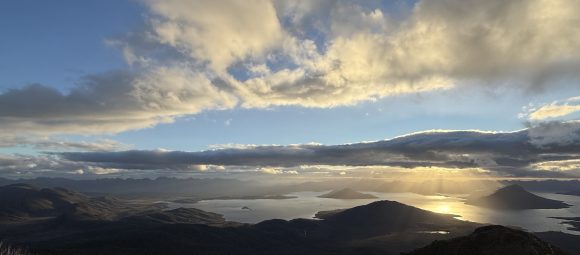
Tassie Traverse – T-Minus Eight Months

“The journey of a thousand miles begins with a conversion to kilometres.” — Anon In the month or so that it took for me to recover from hiking the Australian Alps Walking Track, two things came to me. The first was the rapid return of all the weight I’d lost. The second was the realisation that I wanted to do something like that again. I considered a lot of possible walks, from WA’s...

Orroral tracking station > Namadgi visitors centre

26.62km +793m -1085 The climb from Orroral valley to the Orroral ridge can best be described as ‘400 vertical meters of fucking bullshit’. And then the road winds down to Honeysuckle Creek tracking station. It’s a beautiful shaded campground, with only 16km left to the visitors centre Past Booroomba rocks, and Mt Tennent comes into view. Down through the thick regrowth to Bushfold flats. I walked...

Pockets hut > Orroral tracking station

31.96km +1058m -1343m Another cold morning. Eagle eyed readers may notice a pattern emerging. The gear I brought is proving to be just enough to keep me comfortable, but only barely. Lesson: do not underestimate overnight temperatures in the Australian alps, even in summer. Even on a short trip. It’s warming up quick, and we’ve got a short sharp climb in our future. Instead of the typical route...
Bill Jones hut > Pockets hut

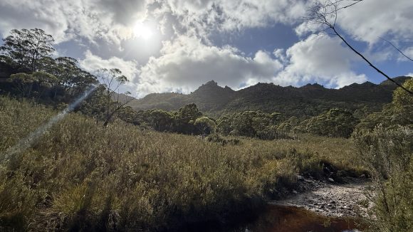
15.4km +286m -318m A little chilly again this morning. We had a cheery little fire to warm up while having breakfast and packing up. We initially headed up the road towards the ruins of Haines hut before cutting across country towards Blue Waterholes. The plain is porous limestone and all the water disappears into the ground, only to pop out again elsewhere. We joined the Nichols Gorge circuit...
Millers hut > Bill Jones hut

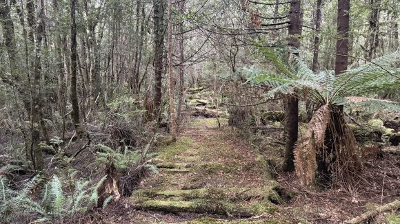
25.6km +530m -617m Feeling somewhat refreshed after twelve hours in the hammock. A beautiful, if somewhat misty and damp dawn. It was a nice enough walk along the Port Phillip trail (though I think we’re some distance from Port Phillip) and mosquito creek trail. The weather is perfect for walking. After Ghost Gully campground the trail becomes less open and the forest provides nice shade. Rod had...
Witzes hut > Millers hut

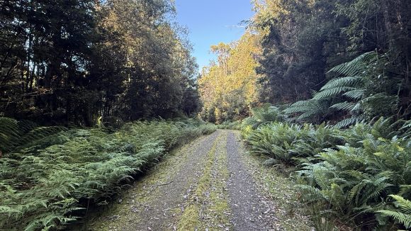
16.7km +393m -419m Another cold morning, though not as bad as the one before. I was packed up and twiddling my thumbs while I waited for Rod to get his shit together. The first few kilometres were unremarkable, though the sky was clear and blue and the temperature quickly climbed to a very pleasant mildness. Open plains and rolling hills and the occasional copse of snow gums. It’s a long walk...
Broken Dam hut > Witzes hut

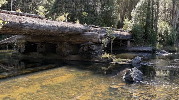
25km +545m -793m It was not six degrees last night. I don’t know what it was, but it was frosty in the morning. In light of that, I think I did a decent job of not being especially cold during the night. Having my cold weather quilt might have been nice though. A beautiful dawn, and we were walking by not long after 7. This flat worm looks mighty round. It didn’t take long before we made it back...

Surprise section hike! Kiandra to Tharwa

10.94km +377m -170m Got driven out to Kiandra by Tim (thanks bro!) and started walking south. It’s good to be back on the track. The wind is strong but not annoyingly so, and just cool enough to counter the warming effect of hiking. Rod, who you may remember from such adventures as “the time two idiots walked a stupid distance mostly together” decided he loved the AAWT so much he’s doing the ⅔ of...

GPX routes and waypoints for GPS.

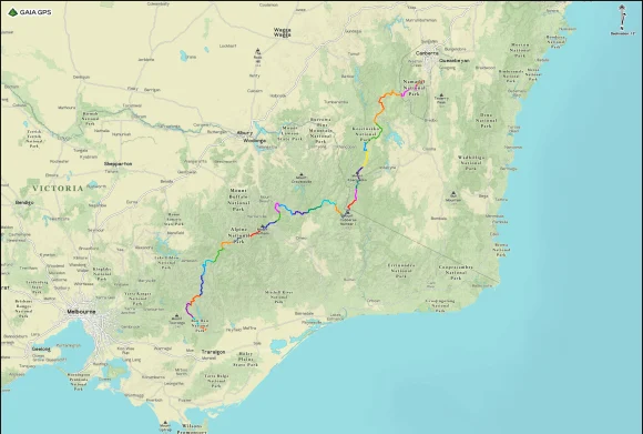
I’ve created two routes for the AAWT that can be loaded into one’s GPS app of choice; one that describes the route more or less along official lines and the other that captures all the side trips suggested by Chapman. I’ve also finished re-doing my GPS waypoints for the walk (all 399 of them!), based on my own experience from last year and Chapman’s notes. This includes...

Epilogue – Reflections and files

Coros watch: 777.16km +31,594m -32,096m GaiaGPS: 761.2km +33,673m -33,404m (including Hotham hitchhike and Thredbo chairlift) It’s simple really. You put one foot in front of the other. As much as possible, you make sure your body has the food and water it needs to keep doing that day after day. You protect the body from injury and disaster so that it can keep doing it. You do this until you...

Day 32 – And whither then, I cannot say

16.52km +336m -803m A clear, mild night with the stars all shining bright, and the moon didn’t rise until late, and a chorus of birdsong to bring in the morning. Some friendly campers loaned me a phone charging cable last night, averting disaster. Mount Tennent, the last peak on the walk (we go over the saddle) beyond which lies the visitors centre and their freezer of assorted ice creams. The...

Day 31 – What rough beast, its hour come round at last, slouches toward Tharwa to be born?

38.33km +1390m -1777m Two paths diverged in the woods, and I took the one with the clearly defined trail markers and cairns, because the other one is like, probably a wombat trail and goes through blackberries or some shit. I woke at 3:30 to climb Mount Bimberi by moonlight and head lamp. The track is fairly indistinct in the dark, and the rocky footpad doesn’t make for the easiest walking, but I...

Day 30 – Sweet smell of sunshine (I’m looking forward to joining you, finally)

33.31km +884m -736m Another foggy morning. Things are starting to look familiar. Starting to look suspiciously like the old tramping grounds. And once the fog burned away, the first real day of clear skies and sun that I can remember in forever. I decided that even though I won’t do my planned loop, I will do an out-and-back to check out Blue Waterholes since the weather is so nice. It adds an...

Day 29 – I’m goin’ down by the river where it’s warm and green

29.86km +544m -578m The sun is out! Photo by Rod We tried crossing the Murrumbidgee at the regular spot, but quickly decided nahfuckthis. We walked upstream a few hundred meters to these rapids: Which we tried to cross, but quickly decided it wasn’t worth dying for. Fuck you for making me get my boots wet for nothing, you overgrown creek We diverted across country to the Snowy hwy, then down Long...

Day 28 – Le tour de hût

27.34km +536m -781m Just a short walk to Kiandra. We decided to cut across country and shave 3km or so off the distance back to the trail. Resupply at Kiandra. Being the last one through has its perks: Thanks Ron and Jimmy for all the uneaten treats! Also in the hut last night were hikers Cameron and Jane from Dunedin in NZ. Jane is doing the AAWT southbound and her husband Cameron is supporting...

Day 27 – He’s going the distance

46.53km +1248m -1227m 14hrs The infant Tumut river I got mobile reception this morning received fantastic news from home: Henry Kissinger, the Forest Gump of war crimes, has finally released his talloned grasp on mortality and fucked off to hell. Celebrating the death of another human may make me ghoulish, but I’ll never be callously-responsible-for-the-deaths-of-millions ghoulish. Swings and...

Day 26 – Don’t cross the river if you can’t swim the tide

22.31km +630m -833m 4am: A hut rat stole all my toilet paper in the night. I will have to improvise until Kiandra. 5am: It rained through the night again. We have to decide whether to attempt crossing the Valentine and then possibly other swollen creeks further north for 12km of slow, wet walking, or go back 4km to Valentines hut (also slow wet walking) and rejoin the official AAWT as it follows...

Zero day – It’s been rain-ing for so long. Don’t you go out in the rain.

The rain started lightly around 8pm last night. Shortly before midnight it ramped up to downpour levels and the wind kicked in. It settled in like that and stayed that way until after sunrise. Around 9am it eased back into a steady shower with occasional gusts and made every indication that it plans to continue with variations on this theme for most of the day. We’ve pretty much resigned...

Day 25 – Fancy meeting you here!

25.22km +874m -923m A terrible night’s sleep on the ground. Rose at 4am as planned just as the full moon set behind the ridge. Still an hour or so until sunrise. Breakfast by headlamp light. Stars shining through patches of dark cloud and the twin black crags of mounts Anton and Anderson, and a smear of brightening red on the horizon like a threat of violence. Photo by Rod Photo by Rod Photo by...

Day 24 – Ground control to Major Tom

21.92km +720m -814m Waiting around for the post office and chairlift to open at a leisurely 9am when we’ve both been ready to walk since 7. I’m feeling like I may have eaten a little too much over the last two days. Up the chairlift! At this point I have to make an apology for the way today’s post goes. The last time I was up here I was ten, and frankly I was blown away by the splendour today. So...

Zero day – I’m just sitting here watching the wheels go round and round

So far: 515.82km +24,432m -23,624 Did some boot maintenance. I’ve got a whole day to kill and not a lot to fill it with. The Lowas have developed two small holes in the leather on one foot, probably from rubbing on the eyelet or laces. And all waxed up: I use a wax of my own making, consisting of beeswax, mink oil, clove oil and cedarwood oil. I’m not sure I’d buy Lowas again. They’ve been fine...
Zero day – Raindrops on rose[lla]s and blisters on bunions

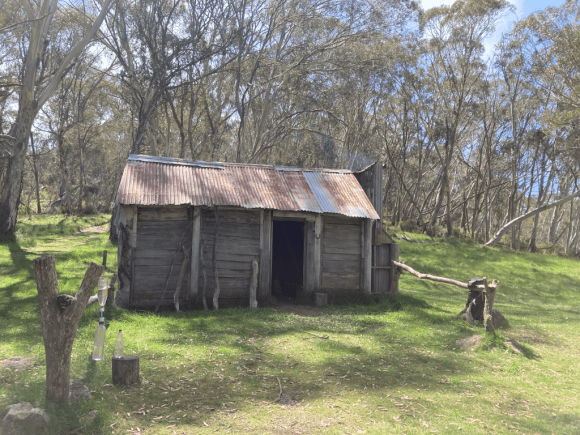
Hotham > Thredbo: 262.92km +10,115m -10,474m I woke up at 5am out of pure habit. Another day for maintenance and organisation. Goodbye to the terrible softdrink bottles I’ve been using since Hotham to filter my water, hello to a new Platypus bladder. I’ll have to be gentle with this one, and when I get home look into a better replacement. With all the crinkles and creases, I think capacity has...

Day 23 – A hard rain’s gonna fall

16.37km +505m -585m It blew a gale all night again, worse by far than last night. I was worried the tarp would pull free of its stakes, but it never did. Fifteen fairly easy kilometres into Thredbo today. South Ram’s Head in the middle there, marking the start of the main range. Finally, after days of boring walking, some nice views and aspects. Even though the last few days have been shortish...

Day 22 – Don’t go chasing waterfalls

19.16km +718m -504m Horses were very close to camp when I woke up. A bit intimidating. I heard them neighing and when I looked, they were about 20 metres away. A few km into the walk, I decided to detour and check out Tin Mine falls. Rod saw the indistinct track and decided to continue to Cascade Hut, presumably anxious to secure the best campsite and lay claim to the tin of spam he heard was on...

Day 21 – Wild horses couldn’t drag me away, from you.

17.9km +592m -517 Not a long day today: about 16km to Tin Mine Huts. A very foggy start. It would not have been a good day for climbing The Pilot, even if I were in the mood for it. Saw some horses, then some deer: Then some more horses; possibly a stallion, mare and foal, grazing on the path we were walking down. We also heard the helicopter not far off and the sound of rifle shots as they...

Categories

Get emailed when I post

Toss me a muesli bar?