28.54km +666m -1658m

(Edit: sorry if you got this in your emails. I just realised it didn’t come over in the migration and had to do it manually)
Morning: things are looking up. The fog that blanketed everything all of yesterday lifted overnight, and this morning the sun is rising bright and clear through the snow gums.
Chapman’s book gives the 25km to Thompson River as taking 12 hours, but it’s possible the track has been cleared since then, so… we’ll see.
[Morgan Freeman: It had not been cleared.]

Feet are warm and dry again. Not sure what was going on with all the water in my toe boxes at the end of yesterday. I’m looking at you, Lowa and Goretex.
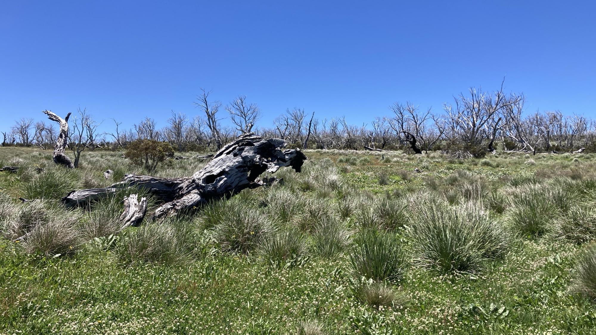
I followed the ridgeline past the ruins of Whitelaw hut until it began to slowly drop from snow gums into denser forest. Stands of Myrtle beech crop up here and there, and for long sections a good haircut of the trail is needed: the actual footpath is clear enough, but the shrubbery is chest high and encroaching.
Myrtle beech, far away in time…
Mobile reception was patchy throughout the day, and never went above one Bar of 4g. (Did you know the measure of mobile reception is not due to the bar graph shape on your phone’s screen, but is in fact named for the inventor of the scale; Montgomery Bar.)
So hopefully I’ll be able to upload yesterday’s post, along with today’s, at some point tomorrow.
And then further down into mountain ash and tree ferns again.
I dropped out onto Thompson Valley road and wandered a hundred metres the wrong way down it in order to fill my water bottles where a creek runs in a culvert under the road. On my way back I noticed a morel growing in the grass on the side of the road!

And then two more.

I ditched my foraging bag out of my pack the day before I left, so I rummaged around and found a substitute. Looking forward to tasting them for the first time.
I was so busy looking for mushrooms that I missed my turn where the track leaves the road and had to backtrack. Then again, it’s an easy turn to miss. The track for the next kilometre or two could best be described as “metaphoric”. I didn’t capture much since I was busy trying not to lose the track, or crawling over or under fallen trees.

At which point I nearly trod on a beautiful tiger snake. She meandered away with the unconcerned demeanour of someone who knows they can kill a horse with their spit.
Eventually you get spit out on an active logging road, which is a fairly stark contrast.


And another snake. This one probably only a year or two old.
Probably a Tiger. Hard to tell.


Steep fire trail down to Thomson’s River. I notice Far Out Guides takes one over Basalt Hill (I followed Chapman’s book), which may be slightly less fire trail-ey.
Down to Thompson River Campsite with its masses of blackberries and ants, and across the log bridge which appears to have had one end shifted downstream about fifteen feet in a flood sometime in the last few months.

I took advantage of the sun to do some laundry (and discovered blood on my shirt, suggesting the itch behind my shoulder is a leech bite) and tried my hand at fishing in the river. Unfortunately, it turns out the fish here are defective and unwilling to jump into my lap. Shame, I think there’s a merit badge for cooking wild mushrooms and trout in the first three days of a thru hike.
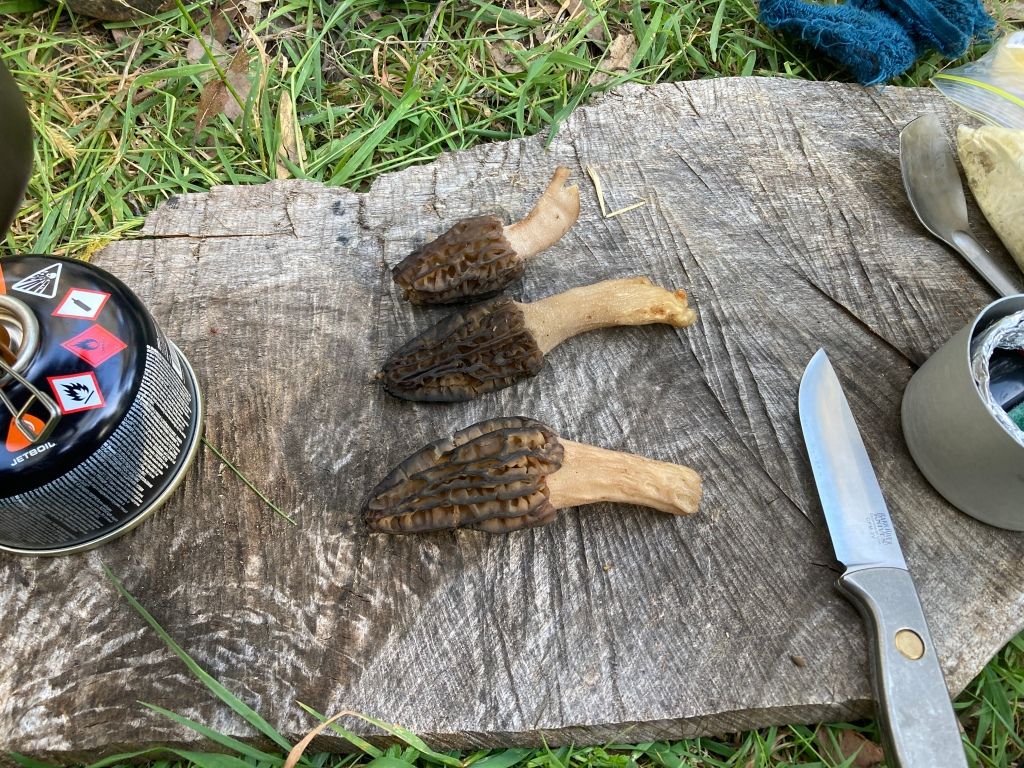
I sliced them up and fried them with clarified butter. I tried a couple bites, and they were nice enough. I added them to my dinner of rice and dehydrated bits.
Last night as I was setting up camp, a group of moss-fanciers (lychenthropes?) walked by. Today I saw nobody.
I did well today. Tomorrow will be interesting. I’m thinking of trying for Fiddler’s Green, but it’s a long way with a lot of climbing to do. I’m a day, maybe a day and a half ahead of schedule. The walk is too big to contemplate, so at this point I’m just focused on getting to my resupply at Rumpff, then to Mt Hotham.